A Woman, A Plan, A Mine… Panama?

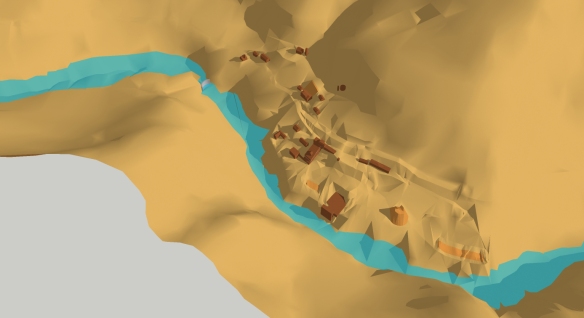
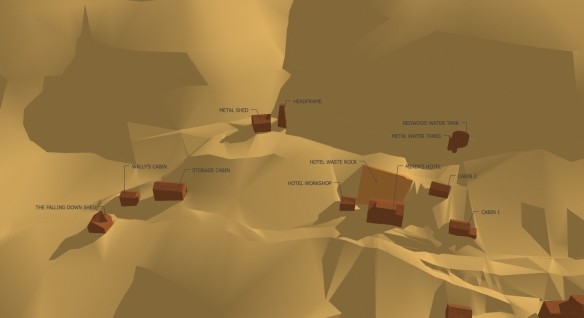
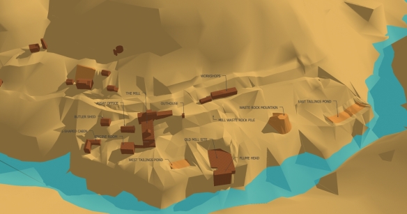
After looking, measuring, drawing, looking again, drawing again, and thinking about palindromes…. I have a drawn up a survey plan that (whilst not accurate enough to build or order materials from) is sufficiently representative of the Ute Ulay site to allow for a masterplan.

Surveys are very important documents, they often document a site immediately before change occurs. The previous landscape quickly passes into history and the survey becomes an historical document, describing the physical site at a particular point in time. They are also the starting point for landscape architectural design.

Surveying is a complex skill, which makes use of some very nifty technology. I am neither a trained surveyor, nor do I have any nifty technology (unless you count computer drawing software). My process is low tech and as accurate as my eyes and brain will allow.

In case you want to try this yourself, the process went something like this:

1. Take satellite images, USGS plans, any other plans you can lay your hands on and combine them in AutoCAD to scale.

2. Try to use on-site observations to re-draw contour lines.

3. Realise that 2. is not going to work because it is extremely difficult to determine contours by eye.

4. Draw sections to scale in AutoCAD.

5. Take printouts of sections to the mine site and re-draw them by eye.

6. Insert 2 dimensional sections (to scale) into Google SketchUp, above the contours you already have.

7. Extrude contours up to their correct height, and alter them according to revised sections.

8. Create 3 dimensional model of the Ute Ulay site in Google SketchUp, and position buildings and other features onto it.

9. Slice through 3 dimensional model at 1 metre intervals (I’m definitely metric), and project slices back onto a plan.

10. Re-draw plan according to new contours in AutoCAD.

Remedial Action

Thanks to all the people who took the time to come to the public meeting on April the 3rd. Since then there have been further meetings with Hinsdale County Commissioners and DRMS.
I have also written a paper for the ECLAS conference in Warsaw, Poland, in September about the Ute Ulay Project; it’s been a busy week!

It was good to get a feedback regarding what is important to locals up at the Ute Ulay mine site. In general people there want the redevelopment of the site to cover a number of areas.

The site should cover historical, economic, and environmental concerns equally. These areas are intrinsically linked by the physical site, and any actions should consider all three at once (even though it is harder and more complicated!).

It is important for the future maintenance of the historic structures that there is some kind of income from the site (since the tax base in Hinsdale is already stretched). This might come from refurbished buildings being let out on a concessionary basis. The best way to maintain a building is to use it. In addition, this might provide opportunities for local entrepreneurs to widen the (very short and intense) tourist season when they need to make most of their money for the year.

For the potential Ute Ulay businesses to be successful, there will need to be visitors. We already know that there are thousands of visitors to the Alpine Loop who pass straight through the Ute Ulay, but if they can read the historical narrative of the site they’ll be more likely to stop – and more likely to return. As Richard Francaviglia notes in his wonderful book Hard Places, historic preservation is a huge tourist attractor in the USA, but many mining landscapes are not valued as much as beautiful old buildings. So, I propose that the landscape be retained and made useable wherever possible. A light touch is needed.

For all of the historical and economic parts to work, the site needs to be considered safe, and the stability of the tailings ponds needs to be addressed. In most cases tailings ponds are remodelled with the implicit assumption that they should be made to look ‘natural’; this strategy was used at the Ute Ulay’s former tailings ponds a little further up the Alpine Loop. The community (at least the ones who came to the meeting) were in agreement that this is not an appropriate approach for the Ute Ulay.

There are more studies due to take place on the ground conditions at the Ute Ulay in coming months. It will be interesting to see what they bring to light. But for now we know that the lead-rich tailings ponds along the banks of Henson Creek are a potential environmental hazard; because ‘release of these tailings during a major storm event or by failure of an impoundment structure would certainly put these materials into Henson Creek’ (Nash 2002). Remediation will involve stabilisation, and this may mean large-scale disturbance of material on site, though the details are still to be worked out.

The Ute Ulay Needs You!

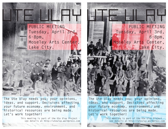
If you’re in Lake City, CO. then please come along to a public Meeting on April the 3rd, 2012. At the Moseley Arts Center on SIlver Street from 6-8pm. The Ute Ulay needs your support to secure its future as a beneficial site for the economy of Lake City, and for those who might want to enjoy this historical site in the future. Come along to this informal session, and listen, share ideas, and consider options for the future.

I even heard a rumour that there might be a little something to eat…


eye-brain-hand

Since May 12, 2011, I have been trying to track down a relatively detailed/accurate survey (paper or digital) of the Ute Ulay. I am a resourceful type, but this task has proved beyond my capabilities.

To say it is frustrating, is somewhat of an understatement! But, after many, many weeks of asking politely, researching, cobbling together and ‘making do’, I am approaching something that I am confident will be useful.

A few days ago, I took my latest (6th version) plans and sections up to the site and went back to using hand-brain-eye co-ordination to draw on top of what I had been able to produce through (mostly) desktop research.

The levels on site are very complex, but also important. The narrative of this site is about earth moving. The ground itself is made of hard work. The lumps and bumps, and rocky expanses are as much historical features as any of the buildings, though people tend not to notice. Landscape is the quiet sibling of architecture. But for all that – it has such depths! The information and multiple histories of the landform tell subtle stories, if you take the time to look. Their rich textures, and chemical makeup flow around you – directing your view or supporting your weight.

By contrast, the buildings sit as discrete entities within the landscape. As humans, I think it is natural for us to focus on the object and not on the background. But imagine if that background changed drastically… would not the whole scene be fundamentally different? Proposals for ‘reclamation’ of the site include re-grading some of the oldest parts of the landform, and obliterating them. In mining, the landscape is a systemic entity, and the rock (waste or otherwise) is part of that. Making the site safe for humans, is not incompatible with using the site to tell the story of it’s own past.

My task of recording the landform and conditions currently on site, is my way of paying homage to their importance. I am not opposed to change, but change should be undertaken for positive reasons, and with respect and sensitivity. My own flawed survey will form the basis for my proposals.

The Old Dam

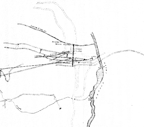
Whilst perusing the Bulletin – United States Geological Survey, Issue 478 I saw on page 86 a tantalising glimpse of Plat V. It showed the lower portion of the Ute Ulay mine site, near the river, and on it was marked the site of the old dam. This was news to me, so I ordered a reprint of the book (the original was published in 1911) and in it was a shrunken down version of the same plat.

Up at the mine I checked as well as I could along the bank, and thought I could make out the remains of a stone wall at roughly the location indicated on the plan. You may be able to make out the the old dam below.

The image above also shows the underground working of the mine which are very extensive. This makes sense of the huge amounts of waste rock which are historical landmarks in themselves.

As a working mine, everything at the Ute Ulay changed many times over. The buildings, landform, and access routes have existed in a fluid state; altering to suit the needs of whoever worked there at the time. For me, this utilitarian attitude to place is the main character of the mine site, and it is what makes it such an engaging place now. The quiet beauty of the atmosphere there seems magnified by the knowledge that it was once a bustling place, filled with people, steam, dust, diesel fumes and noise.

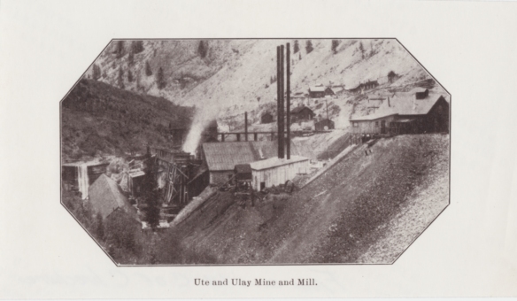
Yesterday, Grant Houston, editor of Lake City’s wonderful newspaper Silver World (which started on June 19, 1875), gave me access to a stash of photographs relating to the Ute Ulay mine. As a prominent local historian, Grant has amassed quite a collection of information about Lake City – including the Ute Ulay.

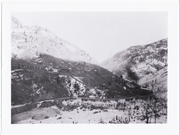
As I looked through the photos, I noticed something in one of them that caught my eye.

On the far left of this image, you can clearly see the old dam referred to on Plat V from the USGS bulletin 478. It was exciting to find evidence of something that may have been otherwise forgotten. It looks as though the dam was made of large timbers. The next time I’m on mine site, I’ll have another look.The image also shows the old mill, the flumehead, and some large waste rock piles – some of which still remain.

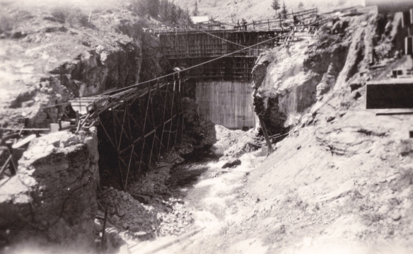
There are a number of structures which are made of in-situ cast concrete at the mine. Part of the blacksmith’s shop and the new dam are made in exactly the same way. Another photo that Grant has, shows the building of the ‘new’ dam (see below).

Today you can still see the imprint of the timbers used in the in-situ concrete being poured in the picture above. The new dam is mentioned in the 1911 book, so must date from earlier than that.

The picture above shows the ‘new’ dam today.

The Ute Ulay is the product of accretion, and I hope that whatever comes next follows in that spirit.

Good Lookin’

It’s a looker!

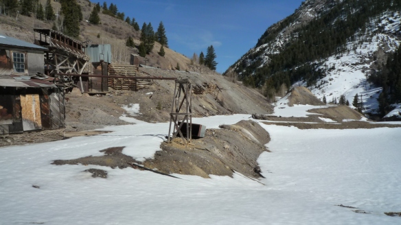
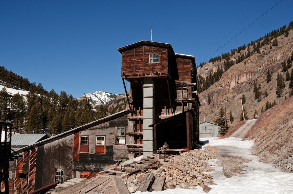
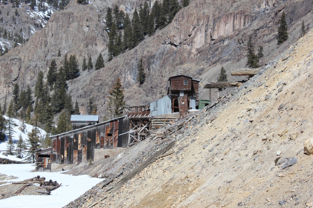
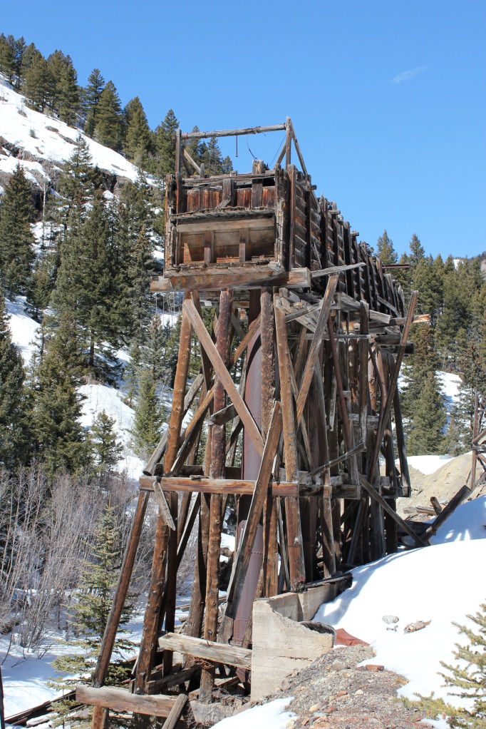
There’s no doubt that the Ute Ulay, with it’s dilapidated charms is a head-turner. The romance of the Wild West lives on in the shabby chic of the buildings, and the dusty expanses of waste rock, set against the sublime and vertiginous Rocky Mountains.

The Ute Ulay site is is private property, and the ‘no trespassing’ signs are strictly enforced. So, it was a treat for everyone last week, when I teamed up with two Lake City pro photographers (Carol Robinson and Craig Palmer) for a look around.

Here’s your treat now – a selection of their lovely pictures!

image Carol Robinson

image Craig Palmer

image Carol Robinson

image Craig Palmer

image Carol Robinson

image Craig Palmer

The Difference Between Rock and Rock

What’s the difference between the waste rock on the Ute Ulay site, and crumbling rocks on nearby parts of the Rocky Mountains?

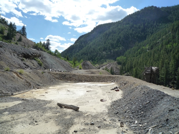
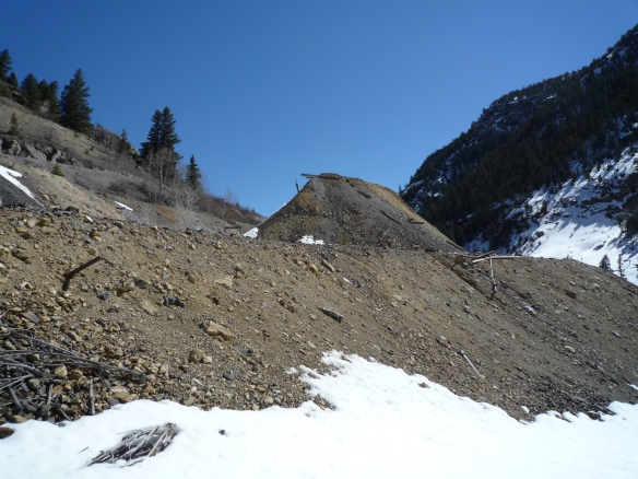
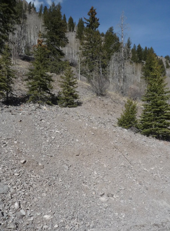
Above is waste-rock at the Ute Ulay. Waste rock is a by-product of lode mining. The miners follow a vein through the inside of the mountain, searching for a rich ore that can then be processed and sold. After the rock has been drilled, and blasted with dynamite, the resulting material is mucked out (shovelled up and taken away). Next, the ore is sorted; the workers look for particular colours and types of rock that they know are mineral-rich. Those are set aside to be crushed, etc. and sold. The rest is waste rock.

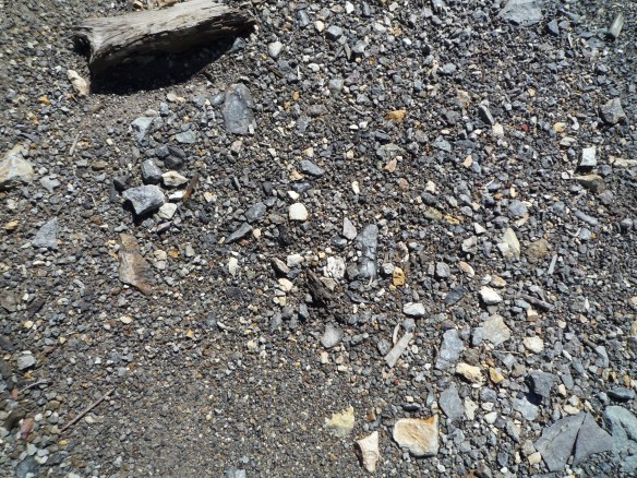
Above are some naturally crumbly bits of the Rocky Mountains. The Rockies are geologically young, which means they are steep, and lots of bits of crumbly rock are still falling off them. It struck me that these crumbly rocks had come from the same mountains as the waste rock, were about the same size as the waste rock, and are heading into the rivers in the same manner that the waste rock does.

So what is the difference? The reason it matters, is that according to current practice here, waste rock requires remediation, whereas naturally crumbly mountain does not. If waste rock is part of the same mountain, and is the same shape and size as other crumbly bits of mountain rock, why are we not either:

a/ just ignoring it.

b/ remediating the entire mountain?

The reasons are twofold. Firstly, the waste rock has been taken from specifically mineral rich areas, and therefore has a higher mineral (potential pollutant) content. Secondly, the crumbly mountain rock has been subject to weathering forces which gradually erode it. So the waste rock is leaching out more minerals, at a faster rate than the naturally crumbling rock. That creates the potential for risks to human health, amongst other things.

There is lots of waste rock up at the Ute Ulay. Part of the process of developing the Ute Ulay site will be to keep people’s contact with the metals present there (lead mostly) to a minimum. After a meeting this morning with representatives from CDPHEDRMS, and Colorado Brownfields Foundation, I have a few things to ruminate on regarding the future shape of the Ute Ulay.The remediation strategies proposed for the Ute Ulay would drastically alter some of the historically important landform.

There is no doubt that the landscape will change significantly. But this is just another stage in the history of this place. It is also an opportunity.

As a landscape architect I am regularly (partly) responsible for changing places. I remember the first site visit I ever went on. It was to a run-down victorian seaside resort called Rhyl in north Wales, and I felt the weight of people’s memories weighing down on me. Who was I to propose any changes?! But it’s part of the job to develop the confidence to alter places – you just hope that you can make it better for most people.

A year after the park in Rhyl was completed, I went back to check on the planting and overheard people telling each other how much they liked the place. It meant more than any award ever could.

Going Underground

A couple of days ago I went underground. Literally.

It all started with a drive to Ouray, which is 19.4 miles away from Lake City as the crow flies. But because (at least in the winter) you have to drive around lots of mountains, Ouray was actually 136.5 miles away.

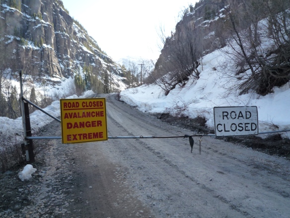
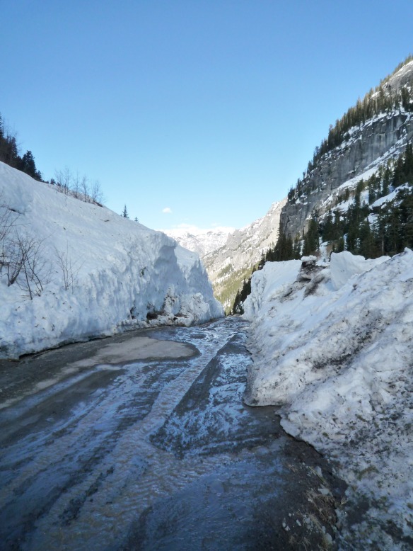
Once there we got to a road which reminded me of the Alpine Loop. The sign on the locked gate was a little ominous.

But our business was further up that road – so we continued on. Past evidence that the sign was accurate…

…until we reached a mine that is being readied for working again after a long period of inactivity. The price of precious metals is currently very high (March 2012). In times of uncertain economies, gold and silver tend to do very well on the markets. I suppose they seem somehow timeless, secure investments. So, it is currently worth re-investing in mines which had previously been un-economic to run.

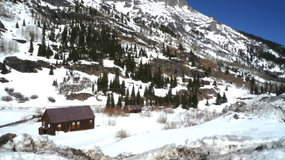
The history of mining is a constant iteration of boom and bust cycles. I imagine all this activity means that we’re currently in a boom. It was possible to see old mining buildings, still on the site from one of the previous mining booms.

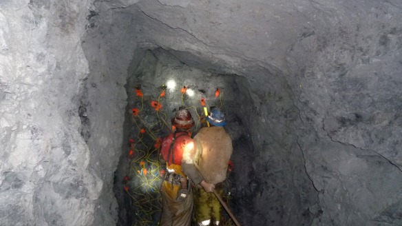
Once up there, we donned the requisite safety equipment and headed down (actually up – though it felt like down) into the mine. It was a little bit muddy, but not unpleasant. The hissing of water and air pipes accompanied us. Many mines rely on air being pumped into them, but this one has natural ventilation, which will be helped along by fans in certain places, as the mine develops.

The miners who were giving me the tour (I will call them Luckies No. 2 & 3) showed me where some fellow miners were drilling into the wall of the mine to make a drill station. From the drill station they will sample the rock to find out the location and size of the vein that they will be mining.

To extract metals, the miners drill into the rock face, and then load it with dynamite to blast out the rock so that they can take the ore to be milled. There is an art to everything; the number of holes you drill, the direction they point in, and the timing of your explosives can all make an important difference.

I was at the mouth of the mine when this particular round went off (far away, and around a corner mum, don’t worry). I felt my lungs compress as the series of explosions took place. The corrugated tin building shook, and I screamed, ducked, and tried to cover my head and my ears at the same time. I am very tough. Luckies No. 2 & 3 thought so.

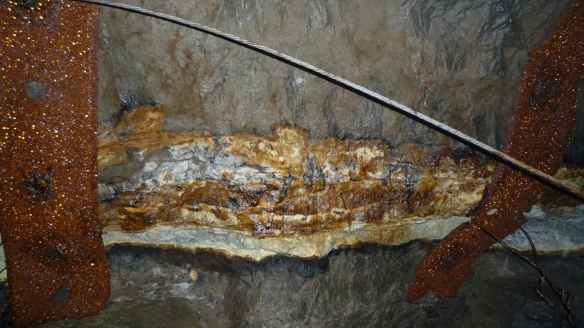
What all of this mining is about, is extracting metals for stockbrokers to trade, for us to wear, and to use in medical, digital, and transport applications (amongst many, many others). We all use this stuff. It’s in the computer you’re using now. And the amazing part is that it was created through the interaction of water and heat and rock – a process called mineralisation. These minerals form in a crack or void that was already present in the rock, and that shows up as a vein.

Some are very skinny, others are wider, and some are fractured. This one is a real corker, each colour represents a different substance, some of which we value very highly. The white is quartz, the yellows are various stages in oxidisation of minerals.

When wandering around the Ute Ulay I often see pretty coloured rocks on the ground and I want to pick them up. I wonder if the very first miners were inspired by pretty rocks too.

The Alpine Loop

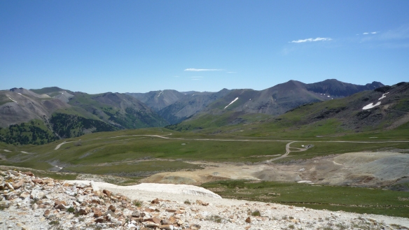
Many folks visit the Lake City area due to the precipitous and thrilling alpine loop backcountry byway. If you have a high-clearance, 4WD vehicle, you can travel over un-metalled, bumpy (terrifying) routes that were carved out by miners in order to access remote work places at up to 12,800 ft. Along the route you will see many traces of mining in the landscape, like the coloured piles of waste-rock and tailings in the mid-ground of the picture below.

You may also see ghost towns, and bits and bobs of leftover mining structures and infrastructure.

Up in Lake City tourism is an important part of the economy. Since the tax base from private land is so low, it makes sense that visitors bringing in money from outside is a great way to boost income. Plus, Lake City is an interesting and unique place – it has a lot to offer the holiday-maker: sublime views, calm and isolation, wilderness, a ski-hill suitable for learners, a whole host of historic buildings, taxidermy galore, friendly mountain men and women, and a cat in the post-office who pops out of the lower PO boxes on occasion.

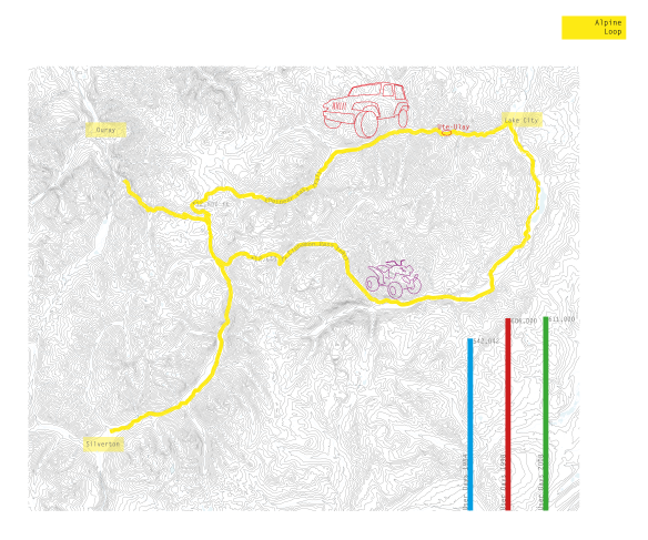
As a confirmed map geek I love the maps created and shared by the Alpine Loop Spatial Analysis and Mapping project (check out this beauty).

The Ute Ulay mine site straddles the alpine loop, about just outside Lake City. There were 611,000 Alpine Loop user days in 2008 – that means there is potentially lots of passing trade at the Ute Ulay. Click on the graphic below to see numbers of visitors.